
- Burke County, North Carolina – (South)
- Caldwell County, North Carolina – (East)
- Carter County, Tennessee – (Northwest)
- Johnson County, Tennessee – (North)
- McDowell County, North Carolina – (South)
- Mitchell County, North Carolina – (West)
- Watauga County, North Carolina – (Northeast)
| Highway Sign | Highway Name | Length | Start | End | Existed |
|---|---|---|---|---|---|
 | U.S. Route 19 East | 75.9 mi | Bluff City, TN (North) | Cane River, NC (North) | 1930 – present |
 | U.S. Route 221 | 153.5 mi | 1930 – present |
COMING SOON
| Location Name | Location Type | Population | Elevation | Named For |
|---|---|---|---|---|
| Altamont | Unincorporated | 1,376 | 3,268 | “High Mountain” |
| Banner Elk | Town | 1,473 | 3,701 | Martin Banner |
| Beech Mountain | Town | 766 | 5,506 | Beech Mountain |
| Carey’s Flat | Township | aka Gragg, NC | ||
| Cranberry | Unincorporated | 538 | 3,130 | Cranberry Creek |
| Crossnore | Town | 239 | 3,369 | George Crossnore |
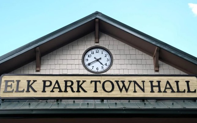
| Elk Park | Town | 495 | 3,166 | Number of elk in the area. |
| Frank | Unincorporated | 222 | 2,982 | |
| Gragg | Unincorporated | 2,664 | William Gragg / AKA: Carey’s Flat | |
| Grandfather | Village | 24 | 3,914 | Grandfather Mountain |
| Heaton | Unincorporated | 337 | 3,045 | Heaton Family / AKA: Ford of Elk |
| Hughes | Township | 3,790 | ||
| Ingalls | Unincorporated | 3,226 | 2,766 | Senator James J. Ingalls |
| Linville | Census Designated Place | 426 | 3,665 | William Linville |
| Linville Falls | Unincorporated | 135 | 3,268 | William Linville |
| Minneapolis | Town | 300 | 3,665 | Minneapolis, MN by Dr. L. E. Clark |
| Montezuma | Unincorporated | 350 | 3,766 | Aztec Chief / AKA: Bull Scrape |
| Newland | Town | 710 | 3,606 | Lt. Governor William Calhoun Newland |
| Pineola | Unincorporated | 982 | 3,550 | Pine trees growing in the vicinity and for Ola Penland, daughter of a local hotel keeper. |
| Plumtree | Unincorporated | 658 | 2,867 | Wild Plumtrees |
| Pyatte | Township | 251 | 3,507 | |
| Roaring Creek | Unincorporated | 438 | 2,982 | Roaring Creek |
| Seven Devils | Town | 441 | 3,944 | 7 Founders / 7 Peaks |
| Sugar Mountain | Village | 371 | 4,432 | Snow on the mountain resembled grains of sugar. |
| Three Mile | Unincorporated | 2,890 | The distance of three miles between US 19-E to US 221. | |
| Vale | Unicorporated | 3,550 |
| ID | Title | Nearest Town | Location | Date Cast | Details |
|---|---|---|---|---|---|
| N-5 | Yellow Mountain Road | Frank | Map | 1938 | Read More |
| N-6 | Cranberry Mines | Elk Park | Map | 1939 | Read More |
| N-18 | Asa Gray | Linville | Map | 1949 | Read More |
| N-22 | Andre Michaux | Linville | Map | 1949 | Read More |
| N-36 | Shepherd M. Dugger | Banner Elk | Map | 1971 | Read More |
| N-43 | Lees-McRae College | Banner Elk | Map | 1993 | Read More |
| N-44 | Crossnore School | Crossnore | Map | 1997 | Read More |
This list includes properties and districts listed on the National Register of Historic Places in Avery County, North Carolina.
The State of North Carolina has a group of protected areas known as the North Carolina State Park System, which is managed by the North Carolina Division of Parks and Recreation (NCDPR), an agency of the North Carolina Department of Natural and Cultural Resources (NCDNCR). Units of the system can only be established by an act of the General Assembly of North Carolina. The park system began in 1916 when the summit of Mount Mitchell became first state park in the Southeastern United States. According to the Division of Parks & Recreation, “the State Parks Act of 1987 lists six types of units included in the NC State Parks System.” These are State Parks, State Recreation Areas, State Natural Areas, State Lakes, State Trails, and State Rivers. All units of the system are owned and/or managed by the division, and the division leases some of the units to other agencies for operation. Most units of the park system are also components of State Nature and Historic Preserve.
| Name | City | Cemetery ID | Memorials |
|---|---|---|---|
| Aycock Family Cemetery | Altamont | 2543418 | 1 |
| Maltba Family Cemetery | Altamont | 2480273 | 2 |
| Pisgah United Methodist Church Cemetery | Altamont | 2180288 | 660 |
| Wise Cemetery | Altamont | 2451923 | 11 |
| Banner Elk Cemetery | Banner Elk | 1993996 | 338 |
| Banner Elk United Methodist Memorial Garden | Banner Elk | 2636713 | 9 |